

Automated Segmentation

An important step in creating a high resolution forest inventory is developing accurate linework and GIS-ready polygons. Traditionally, this has been a manual, subjective, non-repeatable, time consuming and expensive process.
Our automated approach to segmentation, enables faster delivery of forest inventory classification at a higher resolution and lower cost than previously possible. It can be used for feature classification workflows, and to vectorize imagery across extensive landscapes and forest management areas, including:
Land Cover Types (water bodies, wetlands, forest stands, other vegetation classes and bare land)
Changes to Land Cover and Land Use (compare line work over time)
Forest and Land Disturbances (forest management treatments, cutblocks, fire impacted areas)
Road Right-of-Ways and Utility Corridors (linear features)
Our approach to land lines image segmentation uses computer vision prediction, and remote sensing to automatically delineate more homogeneous and reliable land cover GIS-ready polygons.
It provides better detail of land cover separation for vegetation cover (forest stands, grasslands, shrubs and crops); water bodies (rivers, lakes, streams); wetlands and bare land areas.
Automation
Automated land-cover classification reduces human involvement to a minimum, significantly improving the timeliness and reliability of results. Our automated segmentation of land cover types is a fully scalable, efficient, fast and repeatable process.
Inputs / Outputs
We use multi-spectral imagery (image data across several wavelength regions) to auto-segment GIS-ready polygons of land cover, including:
vegetation cover, bare land areas
water bodies and wetlands
Better Outcomes
We enable applications, such as object-based image analysis workflows. We provide better land cover and image feature classification (vs. pixel-based analysis) for vegetation management and forestry inventory stand applications.
How do we start?
Send us a shapefile of an area of interest and we'll provide you with an example of our land lines image segmentation. Our auto-segmentation process is scalable and flexible - supports multiple platforms, applications and data sources.
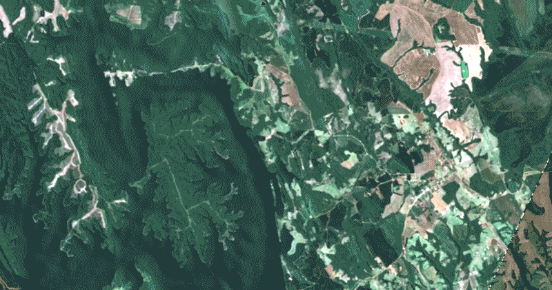
Results Shown Over True-Colour Satellite Imagery
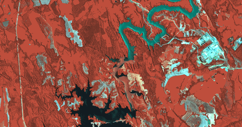
Results Shown Over Colour-Infrared Satellite Imagery
_____________________________________Large vs Small Land Line Polygons
Large polygons (~60 acres) are useful for gross land cover delineation and vegetation disturbances (forest cutblocks or crop loss events). Smaller polygons (~0.5 to 2 acres) are useful for finer feature delineation like smaller streams, right-of-ways, and vegetation corridors.
This process was developed over several years of research automating image segmentation workflows for high accuracy forest stand and block delineation. The adaptation of this algorithm was trained on imagery from several dozen cloud-free scenes ranging from 10 to 10,000 square km (from natural landscapes all over the world including Canada, USA, Central and South America). Note that clouds, shadows and snow will influence the results.

Large Line Polygons
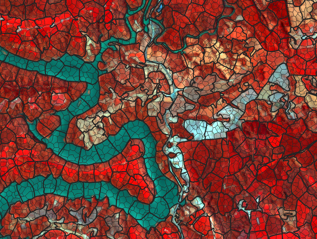
Large Land Line polygons overlaid on top of Small Land Line polygons